![C&G Partners [logo]](https://www.cgpartnersllc.com/wp-content/uploads/2025/09/CGP20_black_orange_RGB.png)

A Wayfinding System for the Longest State Trail in America
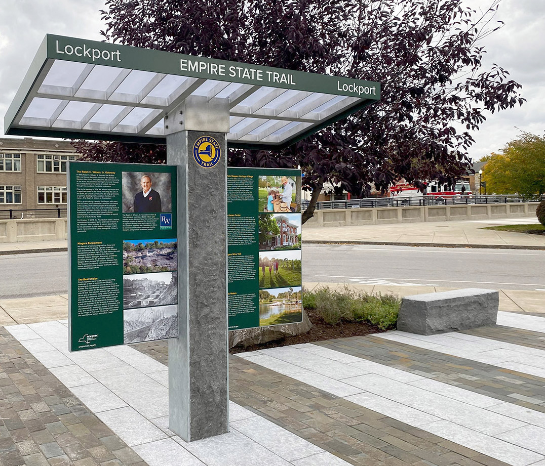
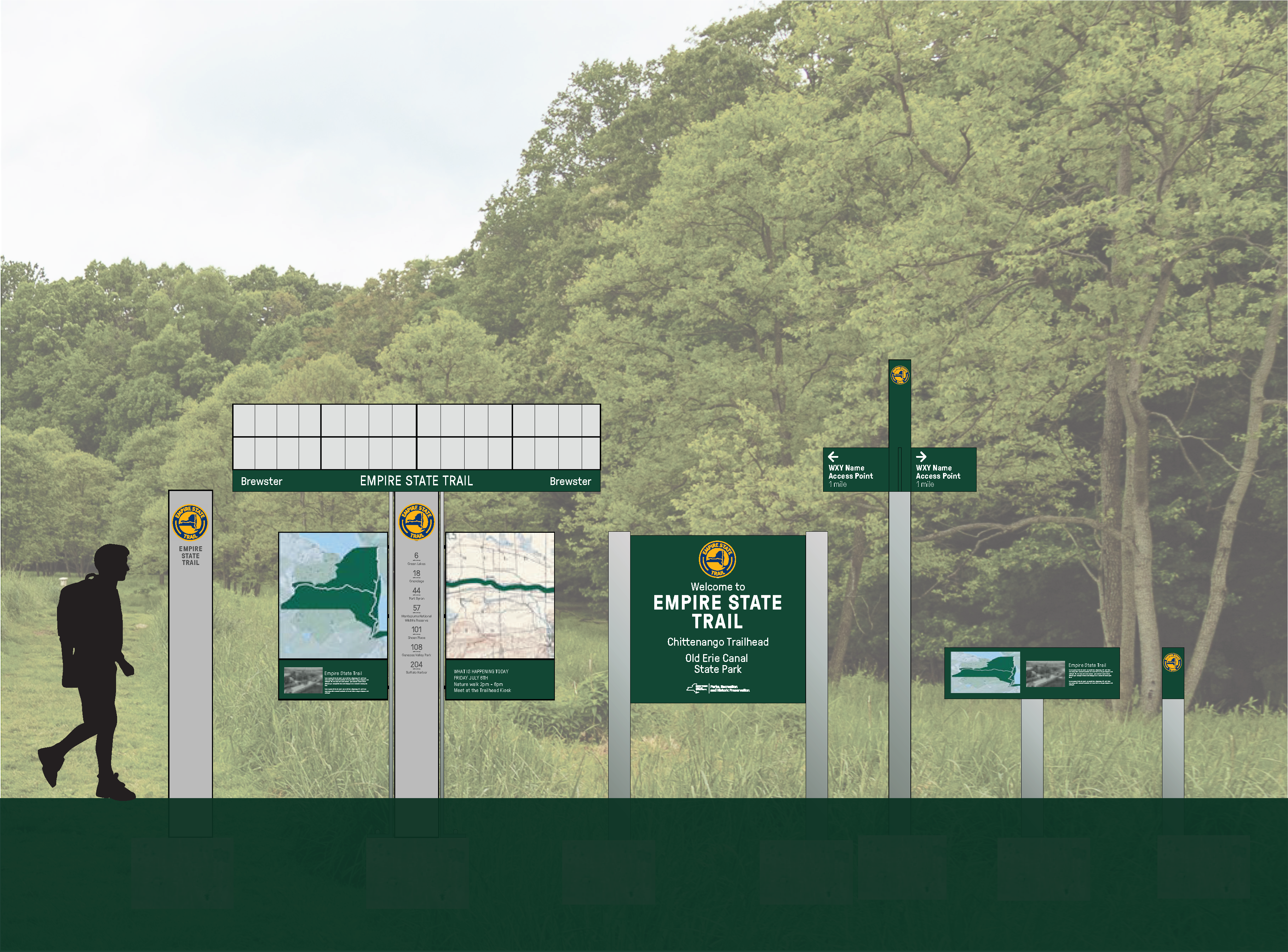

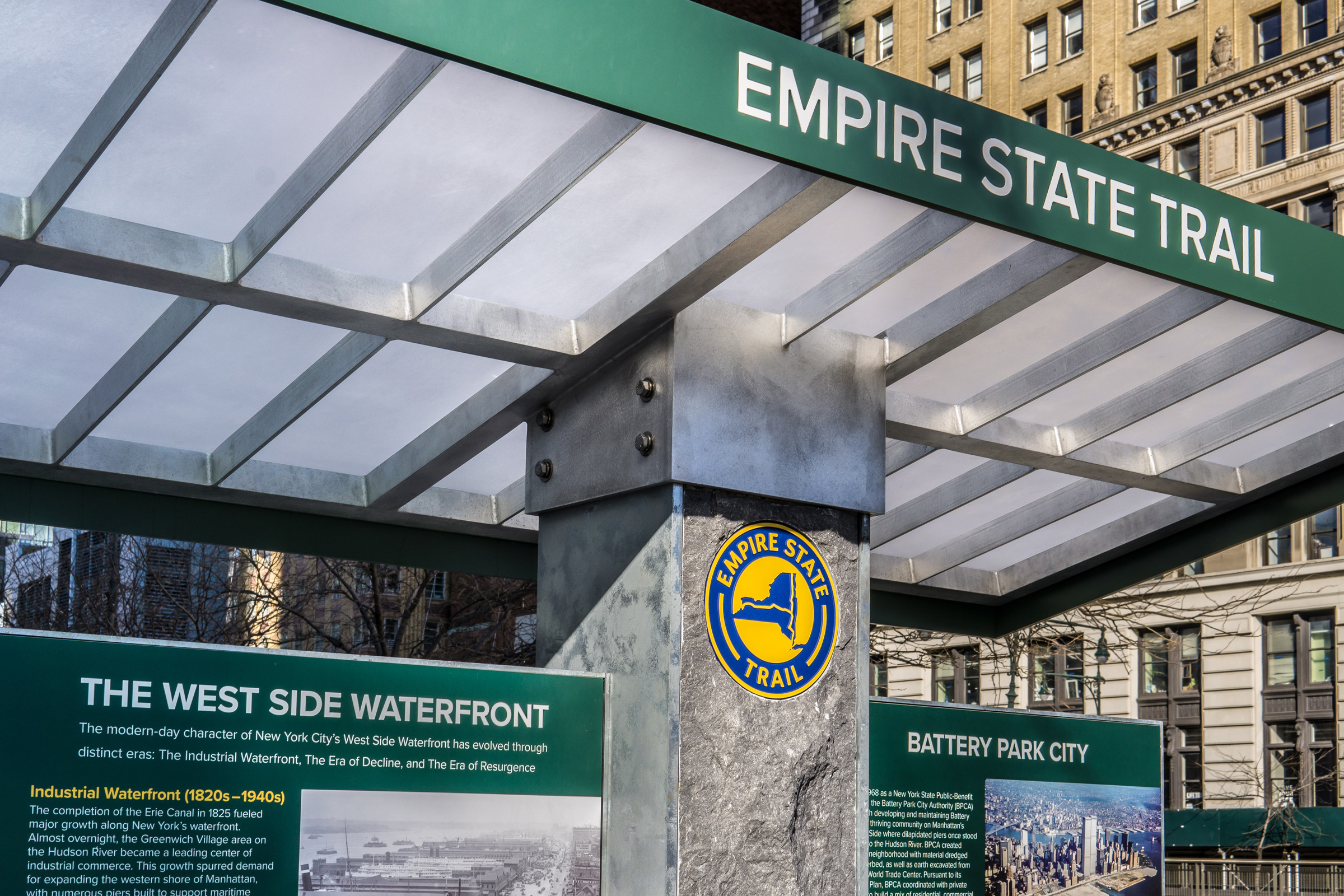

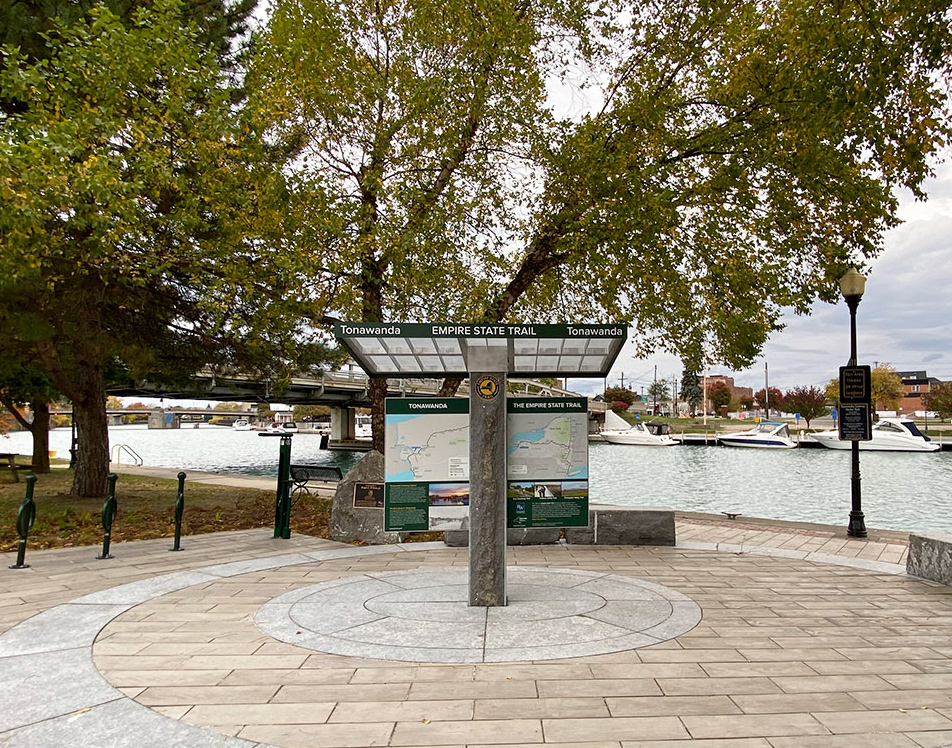
Empire State Trail is the longest multi-use state trail in America, with 750 miles of trails and a project cost of $200 million. It hosts runners, hikers, and bikers from New York City all the way to the Canadian border, and from Albany to Buffalo along the Erie Canal. C&G Partners designed a wayfinding master plan for trail gateways, signage, and interpretive displays distributed across an entire state. The project gateways feature local stone, galvanized metal details inspired by highway infrastructure, and translucent roof planes for illumination of content below. The system includes an ensemble of sign types to address diverse trail conditions across 750 miles of pathways. In the trailhead gateways, custom cartography places the local district into the overall trail context while interpretation offers neighborhood stories and insights about cultural and retail venues. Attractions along the trail include 200+ New York State microbreweries. The Empire State Trail Brewery Passport, which is connected to the ThinkNYDrinkNY app, challenges trail users to explore them all. The master plan was created in collaboration with NYS Parks, landscape architects Starr Whitehouse, and Alta Planning + Design.
Image Courtesy Starr Whitehouse Landscape Architects and Planners and Empire State Development Corporation